To reduce pollution, we need to know it.
Whether you are an occasional paddler or a beginner, a weekly rower registered in a club, an experienced sportsman/woman, an eco-adventurer as part of an expedition, or even a simple hiker: your presence on the water or at the water’s edge is a great opportunity to document what is around you and help advance the protection of “transfer routes”.
The PADDLE & PROTECT project identifies the scientific protocols developed by partner laboratories and NGOs and distinguishes the tools usable in stand-up paddling, both in the river and coastal zone, directly on the water or from the banks, to contribute to the mapping of threats to our rivers, and thus advance knowledge of the ecological status of aquatic ecosystems, by working on three priority threats:
. plastic pollution (macrowaste),
. global warming (drought, temperature),
. toxic chemicals (pesticides, microplastics, cigarette butts, detergents, etc...).
Each year, a flow of more than 8 tons of waste is being drained into oceans. Although rivers have been identified as a major vehicle for the introduction of rubbish into the marine environment, there is currently little knowledge of the quantity and composition of waste transported by rivers.
At an individual level, adopting a Zero Waste way of consumption is very relevant. More globally, contributing to waste mapping, to its location and characterisation is an effective way of working with the institutions at the source to counter this bane in a sustainable way by identifying more clearly its origin and the phenomena that caused it.
That’s why we’ve selected the following tools that we think are most effective for the paddle community :
In France & in Europe
This protocol proposes 3 levels of waste accounting :
- SIMPLE ASSESSMENT FORM: plastic bottles are isolated from the rest of the rubbish.
- INTERMEDIATE FORM: waste is classified into 34 categories.
- ADVANCED FORM: in order to supply the central hub developed by the European Environment Agency, it is proposed to carry out a complete quantification according to the European harmonised protocol Marine Litter Watch.
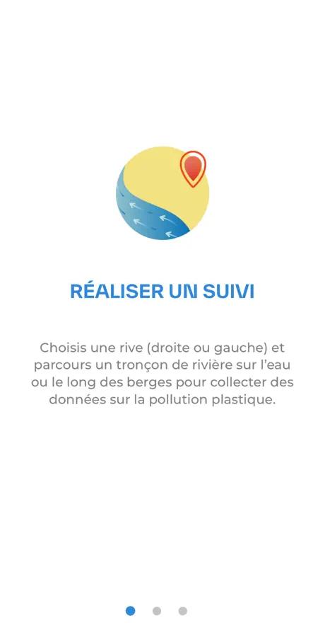
Map plastic pollution in rivers with the Plastic Origins protocol.
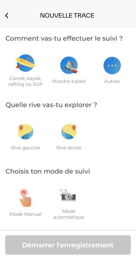
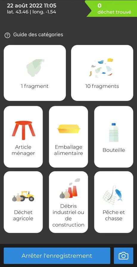
Plastic Origins is the preferred protocol used within Watertrek. Developed by Antoine Bruge, this application to be installed on your smartphone makes it possible to map the presence of plastic on the left or right bank of a river, either from a boat or during a walk along the riverbank. Rubbish is automatically classified into 10 categories. It is not necessary to use the tool for the entire distance travelled on foot or in SUP.
You can create your own account or use Watertrek's. Contact us for login details.
In France
As part of the action plan “Zero plastic waste at sea” launched by the Ministry of Energy Transition and its COPIL Transfer routes, which Watertrek is a part of, CEREMA is in charge of carrying out a mapped inventory of the accumulation of plastic macro-waste in streams and rivers.
From october 2022 and for about 6 months, you can now fill out the signalement form here each time you identify an area that is littered with waste (under a bridge, in a meander and close to water).
In North America & in Australia
Drought is a major consequence of global warming on rivers. In 2022, the Rhine and other major rivers in Europe saw their levels fall exceptionally low.
In Europe
The site is in English. You can create your own account or use Watertrek’s. Contact us for login details or ask us to act as an intermediary.
In France
If it is initially a sensitive sensor installed on leggings worn by surfers for a minimum of 100h in salt water, the possibility of placing this sensor under a paddle board and thus performing measurements in river is under study. Contact us for updates via paddle&protect@watertrek.org
In Europe & the rest of the World
The NGO - a member of Earthwatch based in Oxford - collects data on the presence of pesticides and sells vials that can be easily transported during an expedition to take measurements. The data must then be entered manually on the online platform.
The site is in English. You can create your own account or use Watertrek’s account. Contact us tfor login details or ask us to act as an intermediary.
Are you a laboratory ? A researcher or PhD student ? An association that has developed a tool ?
If you wish to enlist paddlers for a specific ecological research, especially in freshwater, contact us at